Sebastian-Ion Nae, Mihai-Eugen Barbu, Sebastian Mocanu, Marius Leordeanu
Proceedings of the European Robotics Forum (ERF), 2026
Abstract
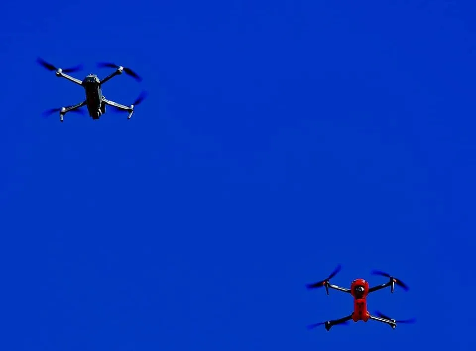
Autonomous agents such as indoor drones must learn new object classes in real-time while limiting catastrophic forgetting, motivating Class-Incremental Learning (CIL). However, most unmanned aerial vehicle (UAV) datasets focus on outdoor scenes and offer limited temporally coherent indoor videos. We introduce an indoor dataset of $14,400$ frames capturing inter-drone and ground vehicle footage, annotated via a semi-automatic workflow with a $98.6%$ first-pass labeling agreement before final manual verification. Using this dataset, we benchmark 3 replay-based CIL strategies: Experience Replay (ER), Maximally Interfered Retrieval (MIR), and Forgetting-Aware Replay (FAR), using YOLOv11-nano as a resource-efficient detector for deployment-constrained UAV platforms. Under tight memory budgets ($5-10%$ replay), FAR performs better than the rest, achieving an average accuracy (ACC, $mAP_{50-95}$ across increments) of $82.96%$ with $5%$ replay. Gradient-weighted class activation mapping (Grad-CAM) analysis shows attention shifts across classes in mixed scenes, which is associated with reduced localization quality for drones. The experiments further demonstrate that replay-based continual learning can be effectively applied to edge aerial systems. Overall, this work contributes an indoor UAV video dataset with preserved temporal coherence and an evaluation of replay-based CIL under limited replay budgets. Project page: https://spacetime-vision-robotics-laboratory.github.io/learning-on-the-fly-cl
Sebastian Mocanu, Sebastian-Ion Nae, Mihai-Eugen Barbu, Marius Leordeanu
Proceedings of the IEEE/CVF International Conference on Computer Vision Workshops (ICCVW), 2025
Abstract
This work introduces a self-supervised neuro-analytical, cost efficient, model for visual-based quadrotor control in which a small 1.7M parameters student ConvNet learns automatically from an analytical teacher, an improved image-based visual servoing (IBVS) controller. Our IBVS system solves numerical instabilities by reducing the classical visual servoing equations and enabling efficient stable image feature detection. Through knowledge distillation, the student model achieves 11x faster inference compared to the teacher IBVS pipeline, while demonstrating similar control accuracy at a significantly lower computational and memory cost. Our vision-only self-supervised neuro-analytic control, enables quadrotor orientation and movement without requiring explicit geometric models or fiducial markers. The proposed methodology leverages simulation-to-reality transfer learning and is validated on a small drone platform in GPS-denied indoor environments. Our key contributions include: (1) an analytical IBVS teacher that solves numerical instabilities inherent in classical approaches, (2) a two-stage segmentation pipeline combining YOLOv11 with a U-Net-based mask splitter for robust anterior-posterior vehicle segmentation to correctly estimate the orientation of the target, and (3) an efficient knowledge distillation dual-path system, which transfers geometric visual servoing capabilities from the analytical IBVS teacher to a compact and small student neural network that outperforms the teacher, while being suitable for real-time onboard deployment.
Daniel Airinei, Elena Burceanu, Marius Leordeanu
Proceedings of the IEEE/CVF International Conference on Computer Vision Workshops (ICCVW), 2025
Abstract
Indoor navigation is a difficult task, as it generally comes with poor GPS access, forcing solutions to rely on other sources of information. While significant progress continues to be made in this area, deployment to production applications is still lacking, given the complexity and additional requirements of current solutions. Here, we introduce an efficient, real-time and easily deployable deep learning approach, based on visual input only, that can predict the direction towards a target from images captured by a mobile device. Our technical approach, based on a novel graph-based path generation method, combined with explainable data augmentation and curriculum learning, includes contributions that make the process of data collection, annotation and training, as automatic as possible, efficient and robust. On the practical side, we introduce a novel large-scale dataset, with video footage inside a relatively large shopping mall, in which each frame is annotated with the correct next direction towards different specific target destinations. Different from current methods, ours relies solely on vision, avoiding the need of special sensors, additional markers placed along the path, knowledge of the scene map or internet access. We also created an easy to use application for Android, which we plan to make publicly available. We make all our data and code available along with visual demos on our project site11https://sites.google.com/view/indoor-navigation-by-vision/.
Sebastian Mocanu, Emil Slusanschi, Marius Leordeanu
arXiv preprint, 2025
Abstract
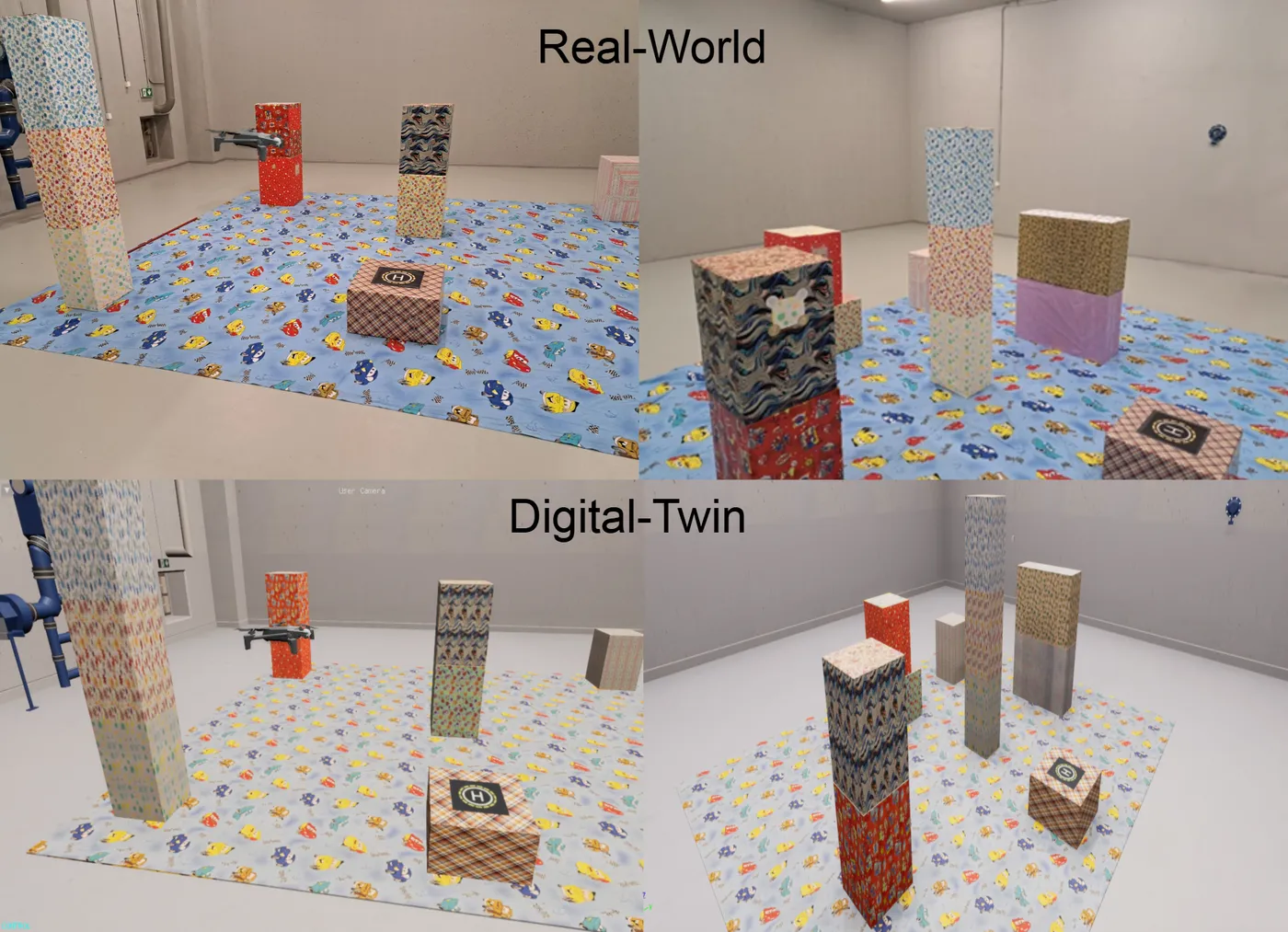
This paper presents a vision-only autonomous flight system for small UAVs operating in controlled indoor environments. The system combines semantic segmentation with monocular depth estimation to enable obstacle avoidance, scene exploration, and autonomous safe landing operations without requiring GPS or expensive sensors such as LiDAR. A key innovation is an adaptive scale factor algorithm that converts non-metric monocular depth predictions into accurate metric distance measurements by leveraging semantic ground plane detection and camera intrinsic parameters, achieving a mean distance error of 14.4 cm. The approach uses a knowledge distillation framework where a color-based Support Vector Machine (SVM) teacher generates training data for a lightweight U-Net student network (1.6M parameters) capable of real-time semantic segmentation. For more complex environments, the SVM teacher can be replaced with a state-of-the-art segmentation model. Testing was conducted in a controlled 5x4 meter laboratory environment with eight cardboard obstacles simulating urban structures. Extensive validation across 30 flight tests in a real-world environment and 100 flight tests in a digital-twin environment demonstrates that the combined segmentation and depth approach increases the distance traveled during surveillance and reduces mission time while maintaining 100% success rates. The system is further optimized through end-to-end learning, where a compact student neural network learns complete flight policies from demonstration data generated by our best-performing method, achieving an 87.5% autonomous mission success rate. This work advances practical vision-based drone navigation in structured environments, demonstrating solutions for metric depth estimation and computational efficiency challenges that enable deployment on resource-constrained platforms.
Marius Leordeanu, Iulia Paraicu
Sensors, 2021
Abstract
When driving, people make decisions based on current traffic as well as their desired route. They have a mental map of known routes and are often able to navigate without needing directions. Current published self-driving models improve their performances when using additional GPS information. Here we aim to push forward self-driving research and perform route planning even in the complete absence of GPS at inference time. Our system learns to predict in real-time vehicle’s current location and future trajectory, on a known map, given only the raw video stream and the final destination. Trajectories consist of instant steering commands that depend on present traffic, as well as longer-term navigation decisions towards a specific destination. Along with our novel proposed approach to localization and navigation from visual data, we also introduce a novel large dataset in an urban environment, which consists of video and GPS streams collected with a smartphone while driving. The GPS is automatically processed to obtain supervision labels and to create an analytical representation of the traversed map. In tests, our solution outperforms published state of the art methods on visual localization and steering and provides reliable navigation assistance between any two known locations. We also show that our system can adapt to short and long-term changes in weather conditions or the structure of the urban environment. We make the entire dataset and the code publicly available.
Iulia Paraicu, Marius Leordeanu
arXiv preprint, 2019
Abstract
When driving, people make decisions based on current traffic as well as their desired route. They have a mental map of known routes and are often able to navigate without needing directions. Current self-driving models improve their performances when using additional GPS information. Here we aim to push forward self-driving research and perform route planning even in the absence of GPS. Our system learns to predict in real-time vehicle’s current location and future trajectory, as a function of time, on a known map, given only the raw video stream and the intended destination. The GPS signal is available only at training time, with training data annotation being fully automatic. Different from other published models, we predict the vehicle’s trajectory for up to seven seconds ahead, from which complete steering, speed and acceleration information can be derived for the entire time span. Trajectories capture navigational information on multiple levels, from instant steering commands that depend on present traffic and obstacles ahead, to longer-term navigation decisions, towards a specific destination. We collect our dataset with a regular car and a smartphone that records video and GPS streams. The GPS data is used to derive ground-truth supervision labels and create an analytical representation of the traversed map. In tests, our system outperforms published methods on visual localization and steering and gives accurate navigation assistance between any two known locations.